


please tag: sotmeu11
Organized by







Talk details
<< back
Volatile Volunteered Geographic Information (VVGI) - The OpenStreetMap example

Peter Mooney, National University of Ireland Maynooth 




Details about the talk:
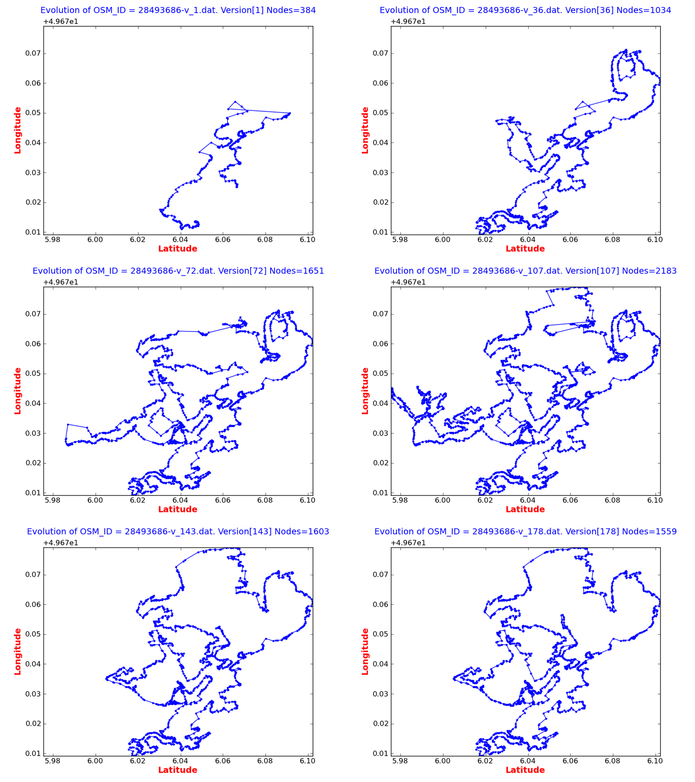
The "state of the map" S(t_n) is the combination of spatial data and cartographic rendering that users download or view of OpenStreetMap at the current time t_n. OpenStreetMap is a dynamic and constantly evolving global database of spatial data and rich annotation. The "map" has evolved to it's current state S(t_n) in a non-linear fashion. This evoluation is what gives OpenStreeMap its completely unique crowdsourced characteristics. Instead S(t_n) evolves from contributors from thousands of editors. Contributors are different in: size of data (bulk upload, gpx tracks, aerial imagery tracing), type of edit/contribution (change in polygon or polyline structure, editing of tags), source of data, etc. In this paper we describe the results of analysis of the history of edits to over 10,000 polylines and polygons from Ireland and the United Kingdom. This analysis provides some very interesting insights into the contributors to OpenStreetMap including: large number of contributors edit a very small number of objects/tags; there are very few large-scale contirbutors, uncertainty regarding placenames, feature names, and feature names can cause tagging disputes between contributors. From the results of this analyis we update the VGI acronym to Volatile Volunteed Geographic Information (VVGI) to more accurately explain some of the unexplainable, almost random patterns of editing, to some polygons and polylines to OpenStreetMap. This work makes a major contribution to the ongoing work on assessing the quality of data in OpenStreetMap. Overall we feel that viewing or analysing the current "state of the map" S(t_n) only provides a certain "view" of OpenStreetMap. The really interesting story is in how polygons and polylines evolve over time. Subsequently many features in OpenStreetMap can be categorised into "stable" and "unstable" based on the number of versions and edits they have recieved up and until the current time t_n.
Details about the speaker:
Peter received his PhD Computer Science in 2004. Since then he has worked as a research fellow with the Irish Environmental Protection Agency specializing in spatial data management, open access to environmental data and information, and geo-informatics. At the Department of Computer Science NUI Maynooth he carries out research on location-based services (LBS) and volunteered geographic information (VGI). His research on OpenStreetMap focuses on developing quality indicators for OSM to improve the perception and usage of OSM
Theme: research
Color key
| Theme: map |
| Theme: powered by osm |
| Theme: research |
| Theme: tech |
| Lightning talks |
Sponsors
Gold



Silver




Bronze



